Optimal routing is an essential part of Voyage planning. Traditionally, optimal routing has been avoiding areas with high risk of cargo damage. With advanced weather forecasting, the forecast period has become longer. With advanced data communication, it is possible to deliver the updated forecasts onboard, and weather routing has become dynamic and adaptive to the real weather and is no longer merely avoidance of high risk areas.
But weather routing is not the only part of optimal routing. As IMO Regulation 34 states:
2. The voyage plan shall identify a route which:
2.1 takes into account any relevant ships’ routing systems
2.2 ensures sufficient sea room for the safe passage of the ship throughout the voyage
2.3 anticipates all known navigational hazards and adverse weather conditions; and
2.4 takes into account the marine environmental protection measures that apply, and avoids, as far as possible, actions and activities which could cause damage to the environment.
In practice, this means optimal route should comply with all regulations, navigate through or around shallows and find the right currents and weather. All in a safe and efficient way! It’s not an easy task for a young 2nd officer (as it is usually left to solely 2nd officer’s task to make the route planning). When crossing the oceans you can concentrate on weather routing, but if the distance between waypoints -forced by factors above – is so short that going around to another weather area is going to make too much extra distance, weather routing is not an issue.
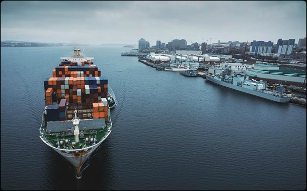
When sailing with different vessels it has become clear to me that while we have really advanced weather routing systems, the other parts of the voyage are poorly optimized. With the help of Eniram’s massive database, I started to look closer into it. I studied how much of the fuel is used in coastal routing (not applicable for weather routing), in our customers’ fleet. Even before conducting the study it was clear to me that on cruise vessels this number was high – and it was over 90%. But for the container vessels it was almost 50%! When digging deeper, it actually makes sense: the whole traffic in East China Sea and South China Sea is coastal, traffic in South America (both sides) is coastal and if you think about it – even Europe-Asia voyage is almost entirely coastal. Actually, in theory, the legs from Gulf of Aden to Sri Lanka and further to Malacca Strait is weather routing area but in practice they are not. Also the beginning and end of the ocean voyage is coastal.
So we are talking about a huge amount of fuel used in coastal routing. But still, if you think about route optimization systems, you will find only weather routing providers. Why is that? Well, the coastal routing optimization is not an easy task – it does not have a mathematical solution. And engineers hate that. You need to have the knowledge of an experienced navigator, database of all rules and regulations in the world, knowledge of high risk areas, understanding of individual vessels squat, sea state and wind behavior, accurate forecast of wind waves and currents, accurate water depth charts and possibility to calculate optimum of all these factors. The human brain (not even a sailor’s brain) can’t do it and a computer program would be so complicated that no one would buy it (if it even works).

Our calculations show an average of ~5% savings potential in coastal routing. So how to save in coastal routing? Why not combine the navigator’s brain AND computer algorithms? I will explain all this in the next part of The Whole Picture.
Stay tuned!
ABOUT THE AUTHOR
 |
Tero Ilus, Director of Nautical Consulting at Eniram has deep understanding of vessels and operators. With additional background as offshore racing sailor and captain on sail training ships he has acquired an interdisciplinary knowledge of optimizing vessel performance in operations and hydrodynamics. During his 20 year sea-going career, Tero has served on several positions proceeding from deck hand to master mainly on training, roro and ropax vessels. At Eniram, Tero is responsible for helping our customers to achieve savings also outside of our main products. As co-inventor of the Eniram Trim solution and pod optimization systems he is also deeply involved in the product development in the company. |
ABOUT ENIRAM
Established in 2005, Eniram provides the maritime industry with energy management technology to reduce fuel consumption and emissions. Created by experienced seafarers and technologists, Eniram’s solutions range from single onboard applications to comprehensive fleet analysis. Eniram is headquartered in Helsinki, Finland and has subsidiaries in the UK, the USA, Germany and Singapore. www.eniram.fi


Leave a Comment